MTS (Mobile TeleSystems) is the largest mobile network operator in Russia with over 80 million subscribers.
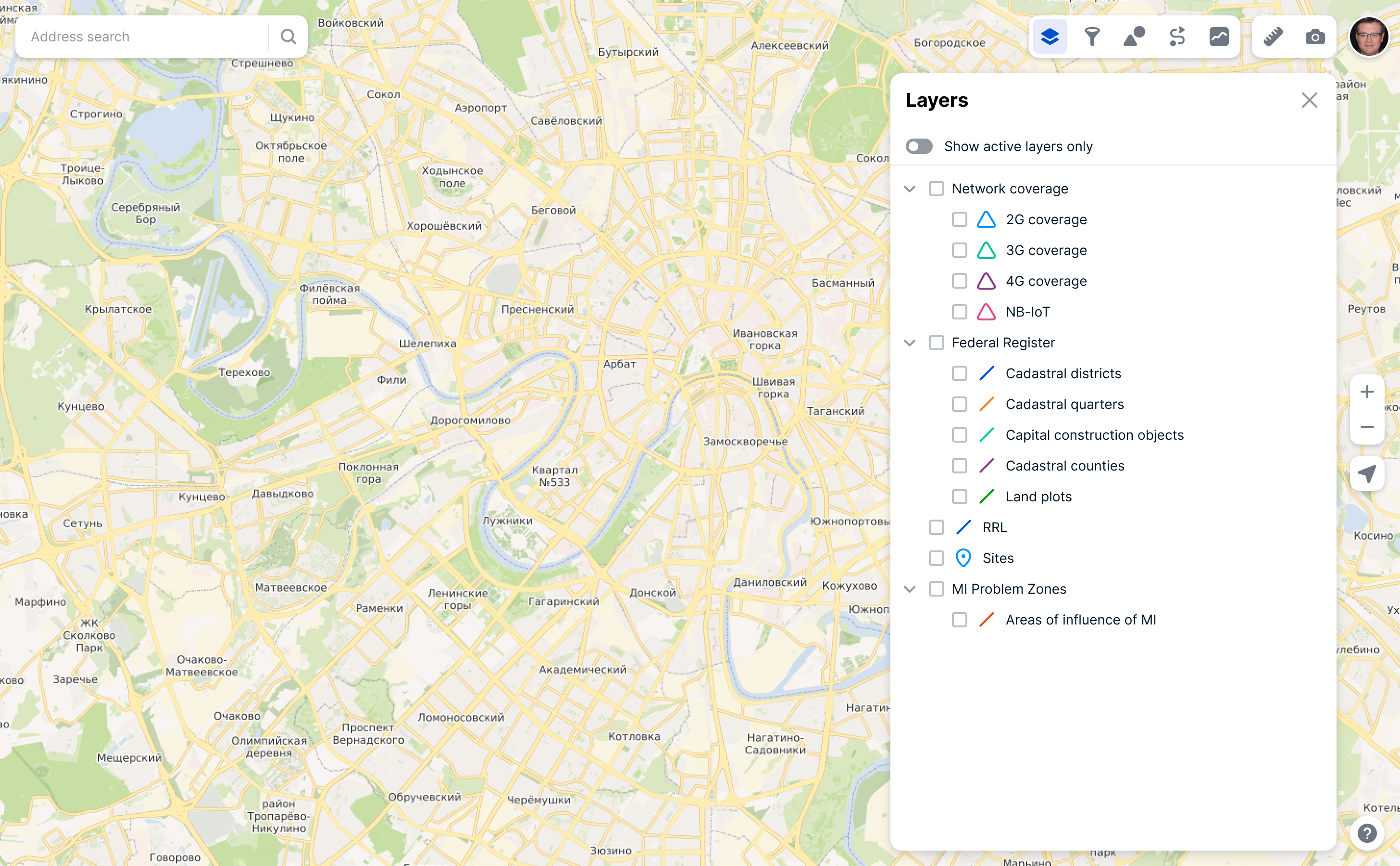
Egis is the internal geographic information system. It stores, processes, and displays spatial data that various departments need to work. For example, technical data: network coverage, sites with base stations and radio relay links. Or sales network data: points of sale and competitors’ points of sale.
The company launched a program to automate internal processes and many new services needed geodata tool.
The existing system had not been updated for a long time and was outdated both technically and graphically. Also it couldn’t be built into other services.
Define business problems, that need geodata
Create tools to solve it
Launch MVP
Use Egis in other projects
PM collected more than 40 user stories and requests from all over the company before start.
We chose features for MVP:
Display object on a map and information about these objects
Filter objects
Shapes
Elevation Map
Route planning
For many features we used plugins because development resources were limited. I improved UX of these plugins and adapted it for our service.
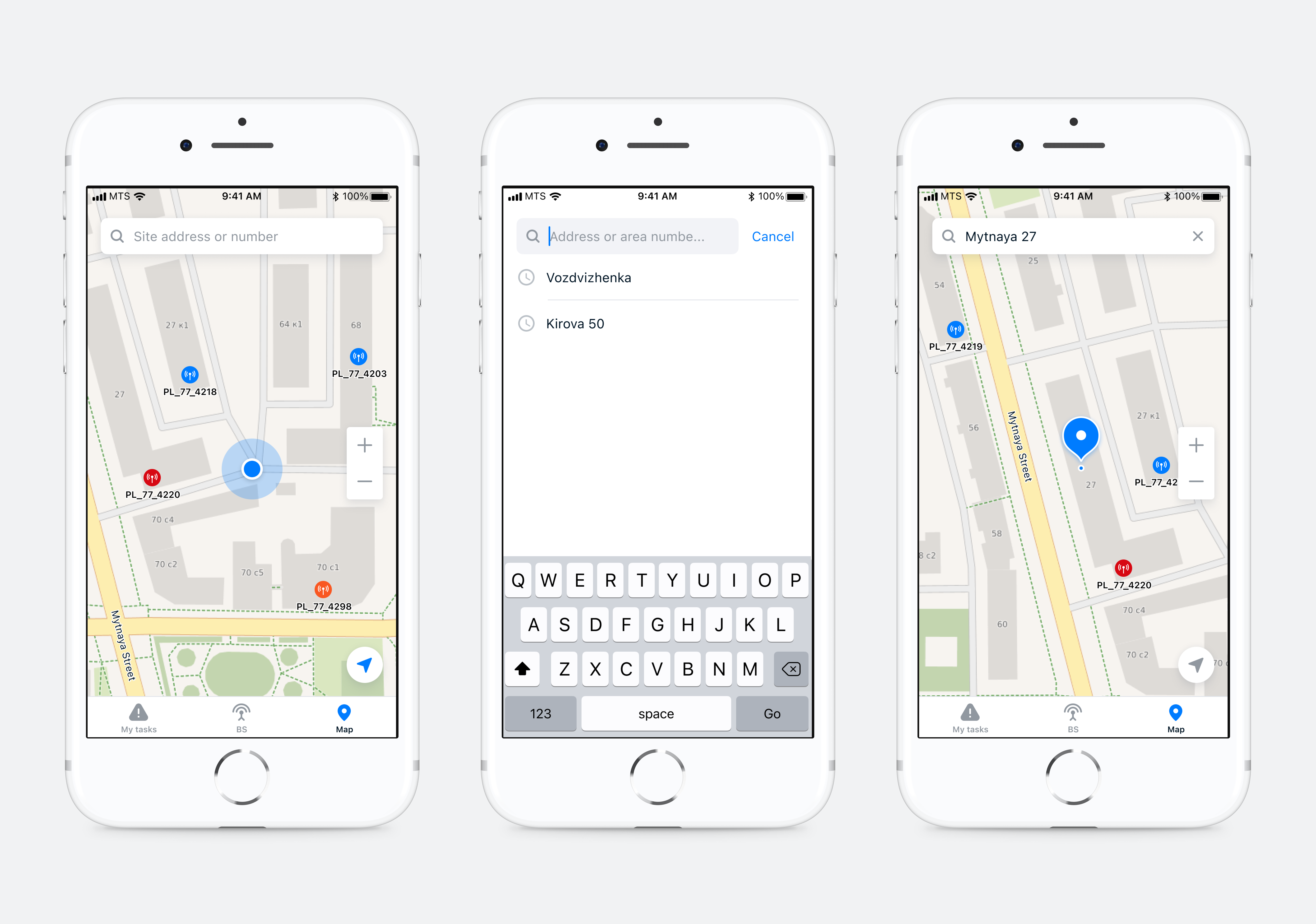
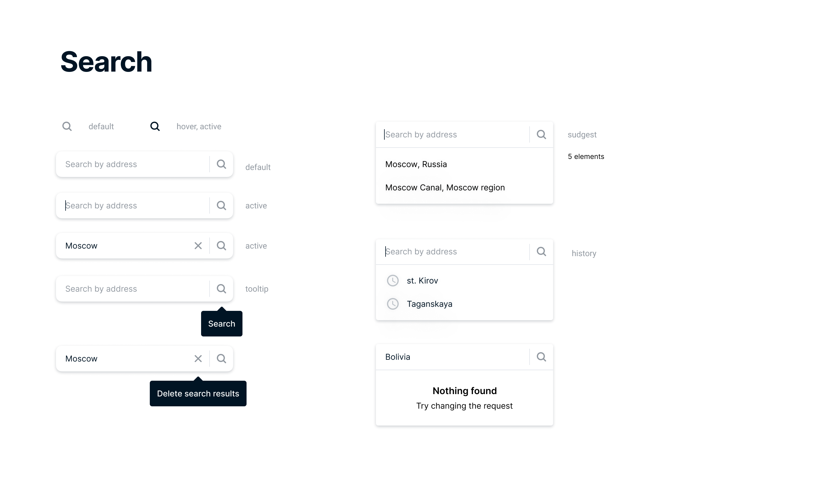
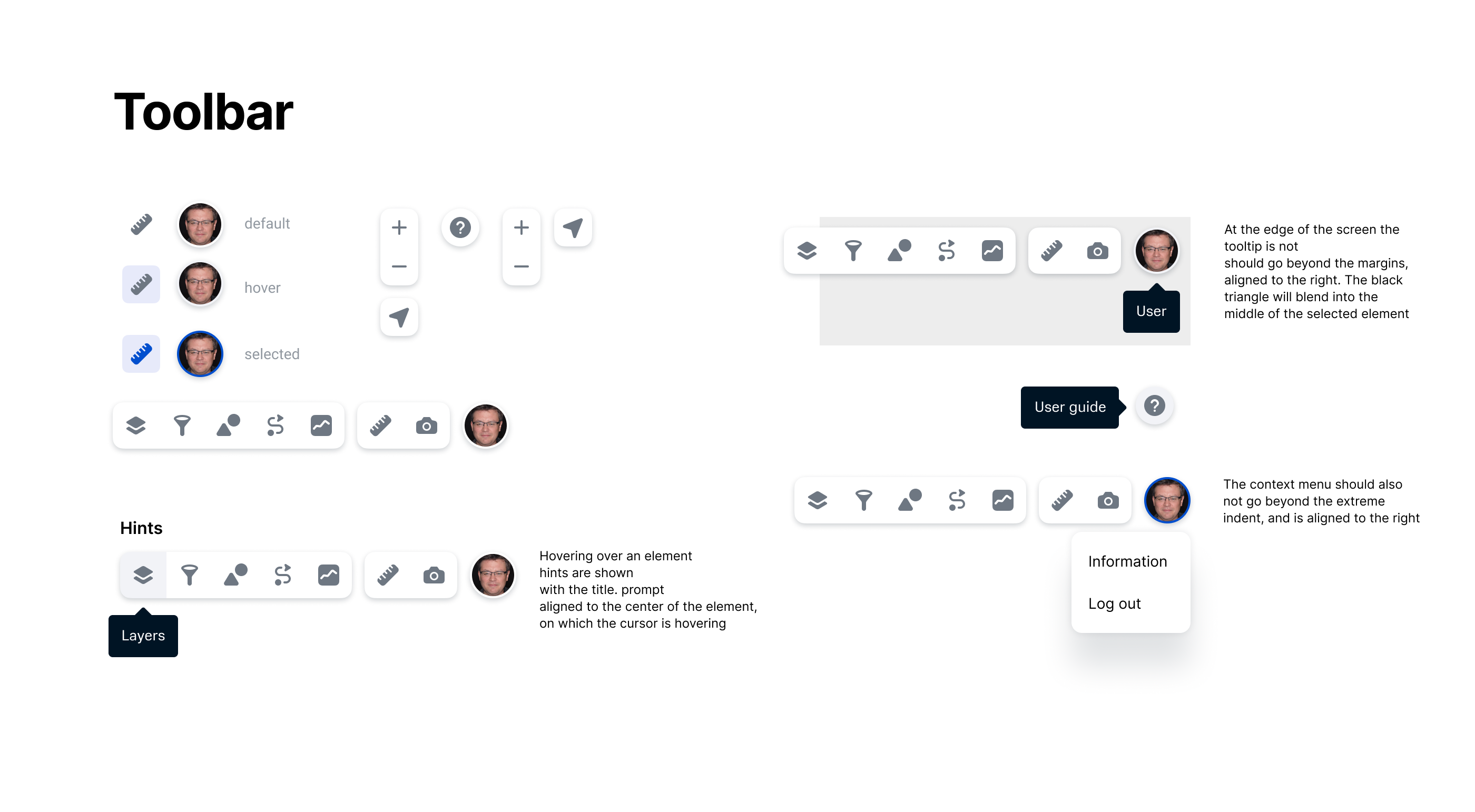
At first, I designed toolbar and search bar, because the work with the GIS begins with the choice of the tool.
The data stored on the geoserver is displayed as layers and layer groups. You can include only one layer or a group of layers. Data is filled in by administrators on the geoserver in the form of tiles with coordinates and additional information (attributes).
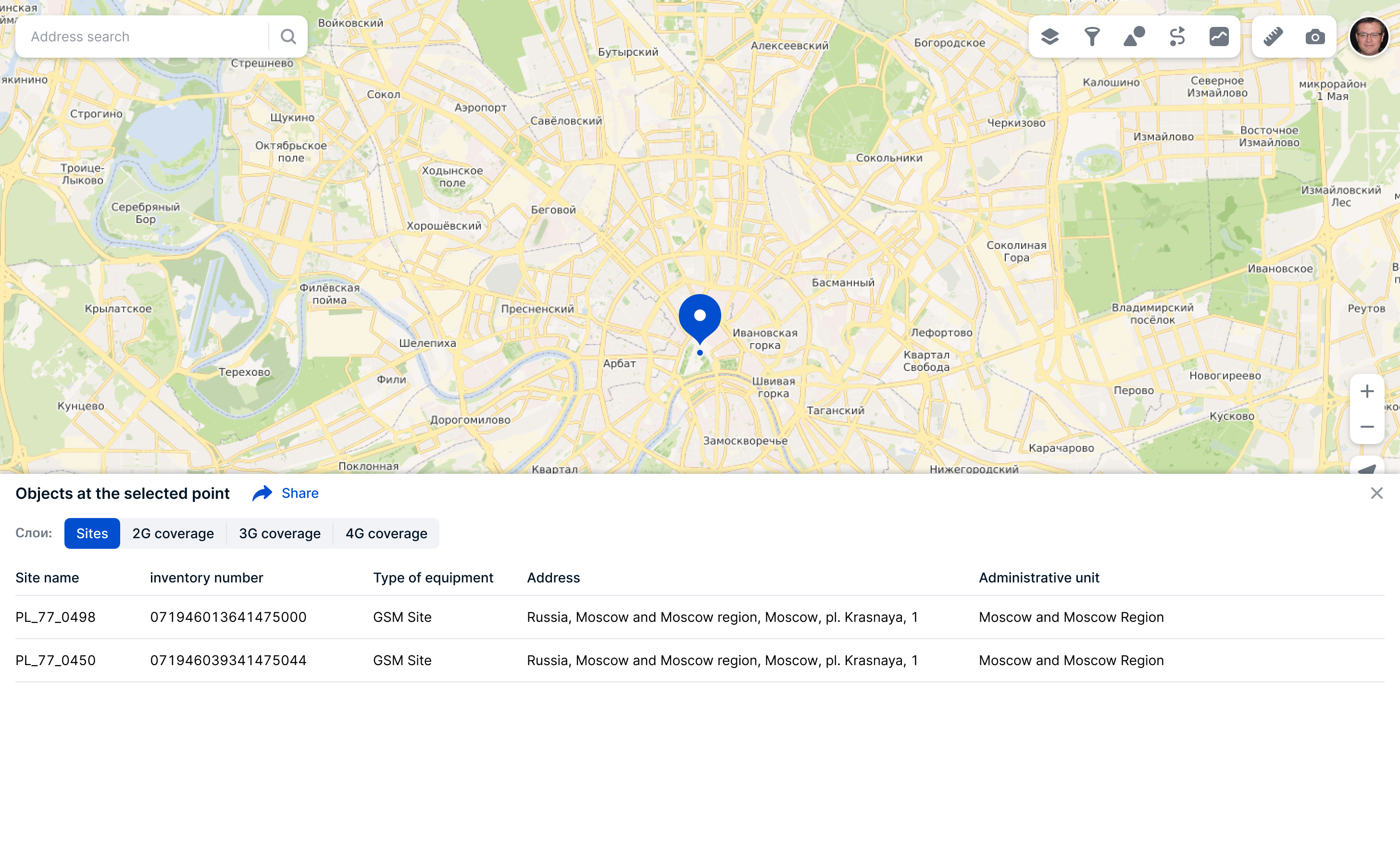
Clicking on any point on the map displays information about the objects in this point. There can be several objects from different layers in one point. After user tests, I have chosen a tabular option for displaying information about objects. This way it is much faster to find the desired object and compare it with others.
I did a lot of quick tests of different variants of information display.
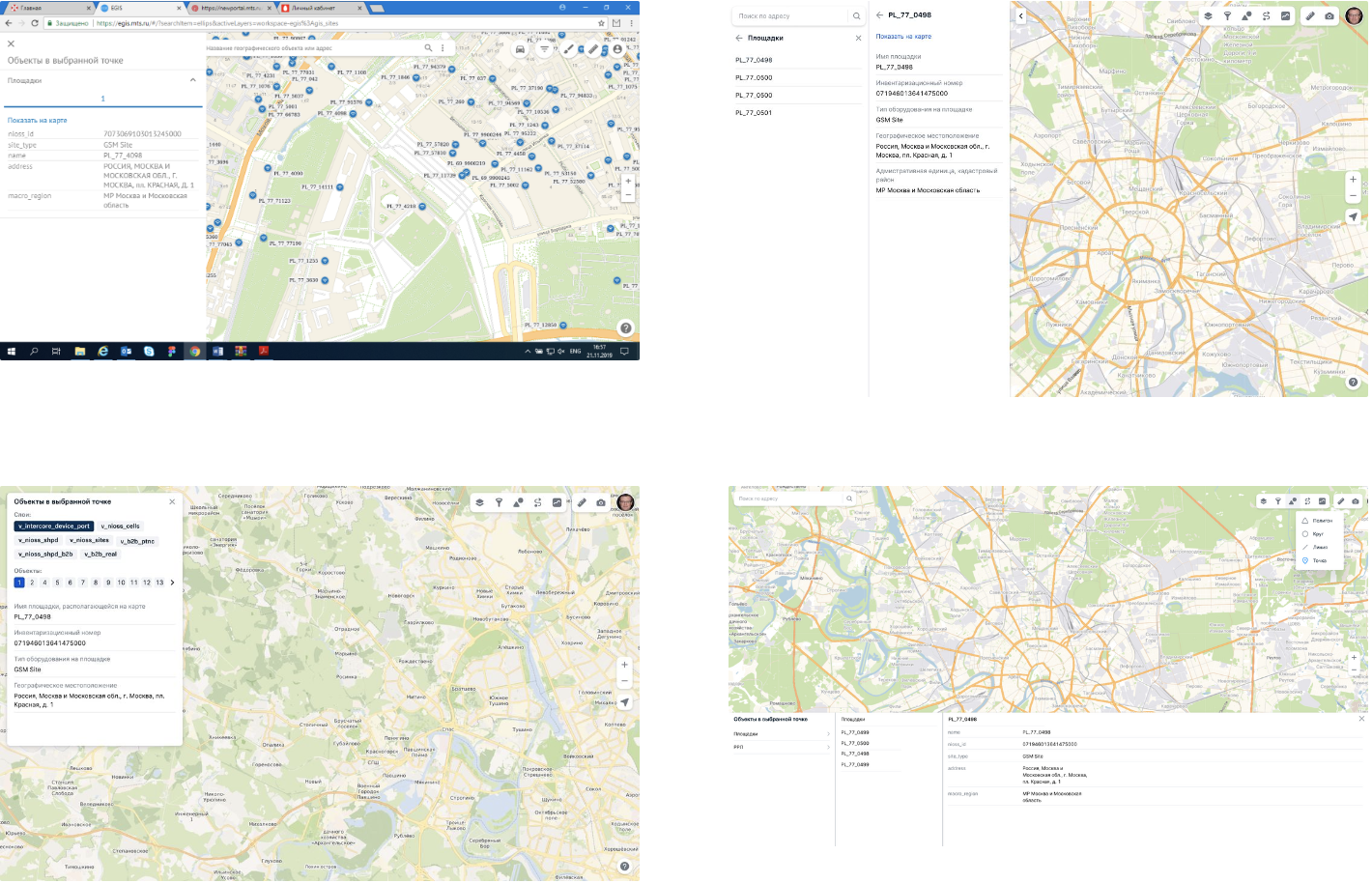
Final table of objects in a point. It was the best solution by the results of user testing.
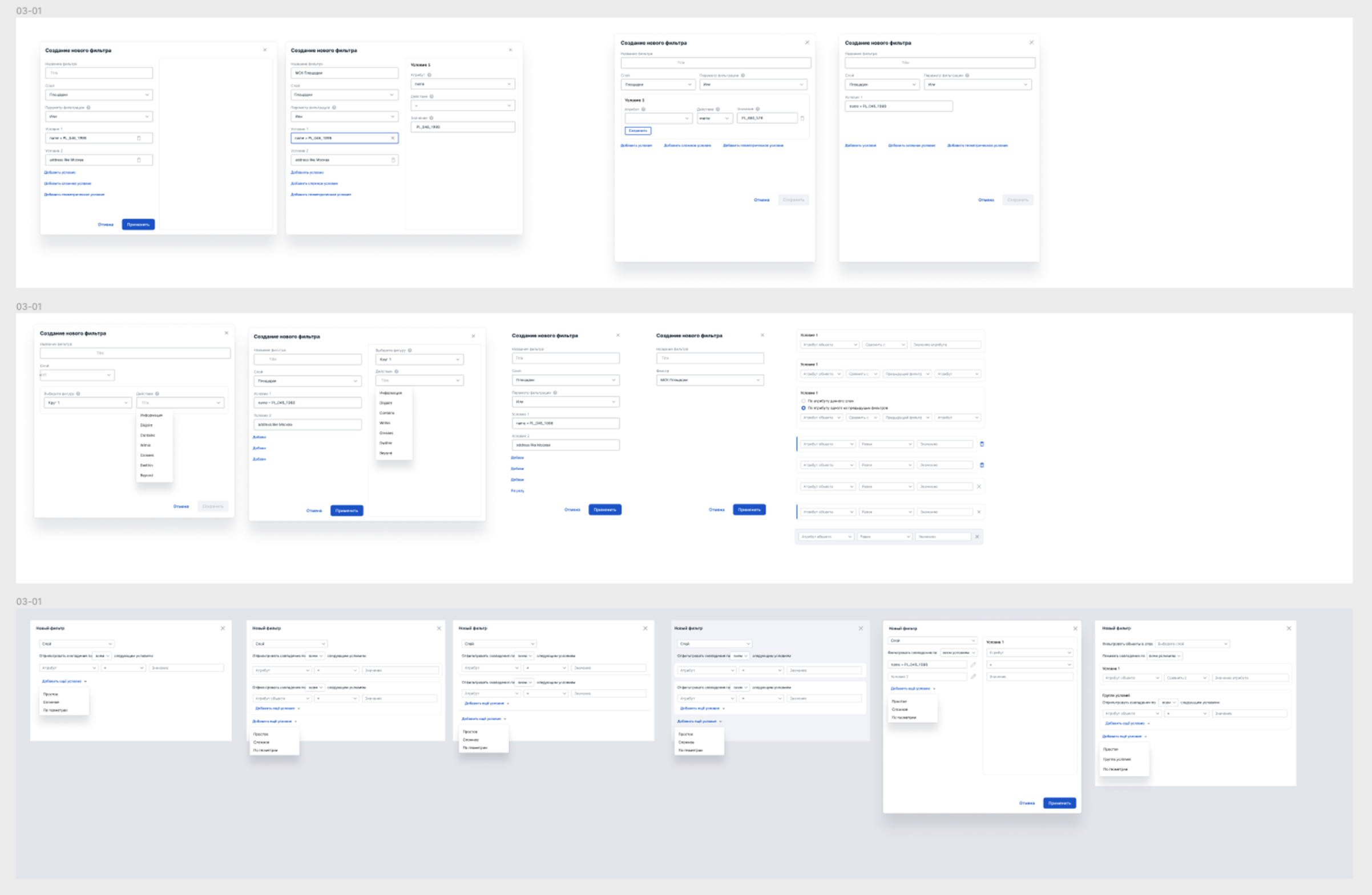
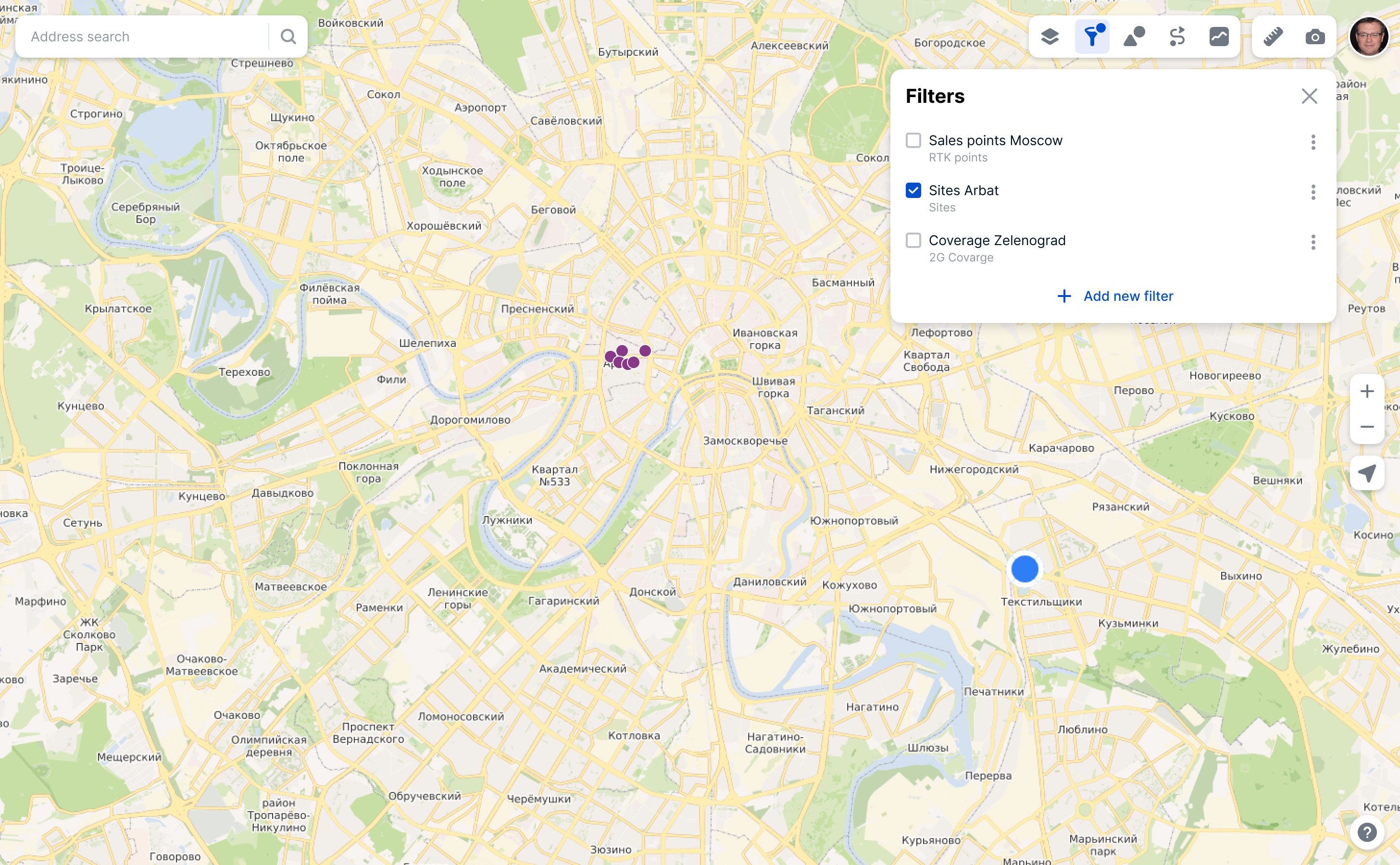
Filters are used to analyze the data and filter the desired objects by attributes. Filters was the most difficult part of work. I discussed it with engineers and did a lot of quick user tests.
The filter is applied to the objects of only one layer. If you enable it, only the filtered objects will remain on the map for that layer.
Create a new filter
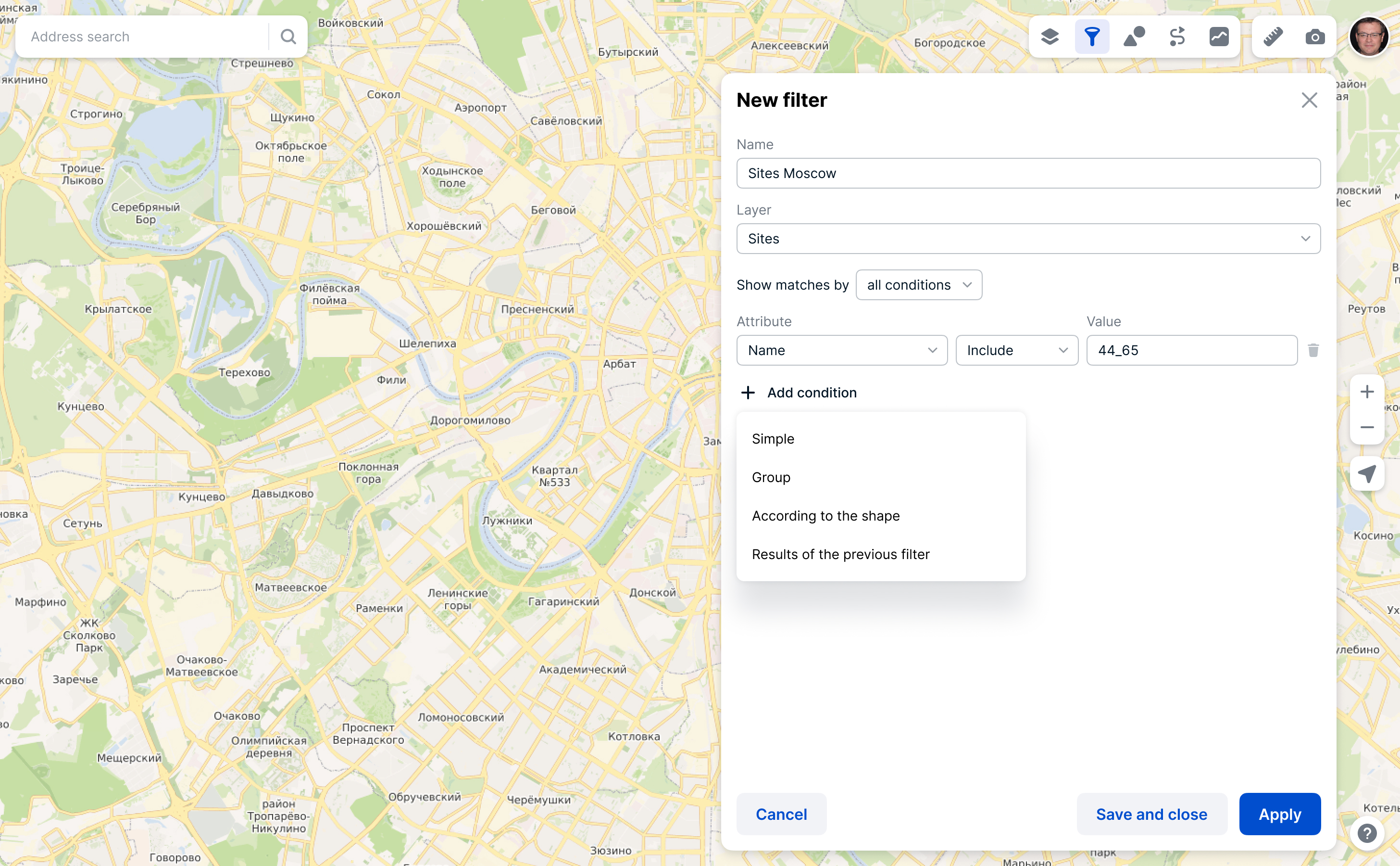
Conditions in filter
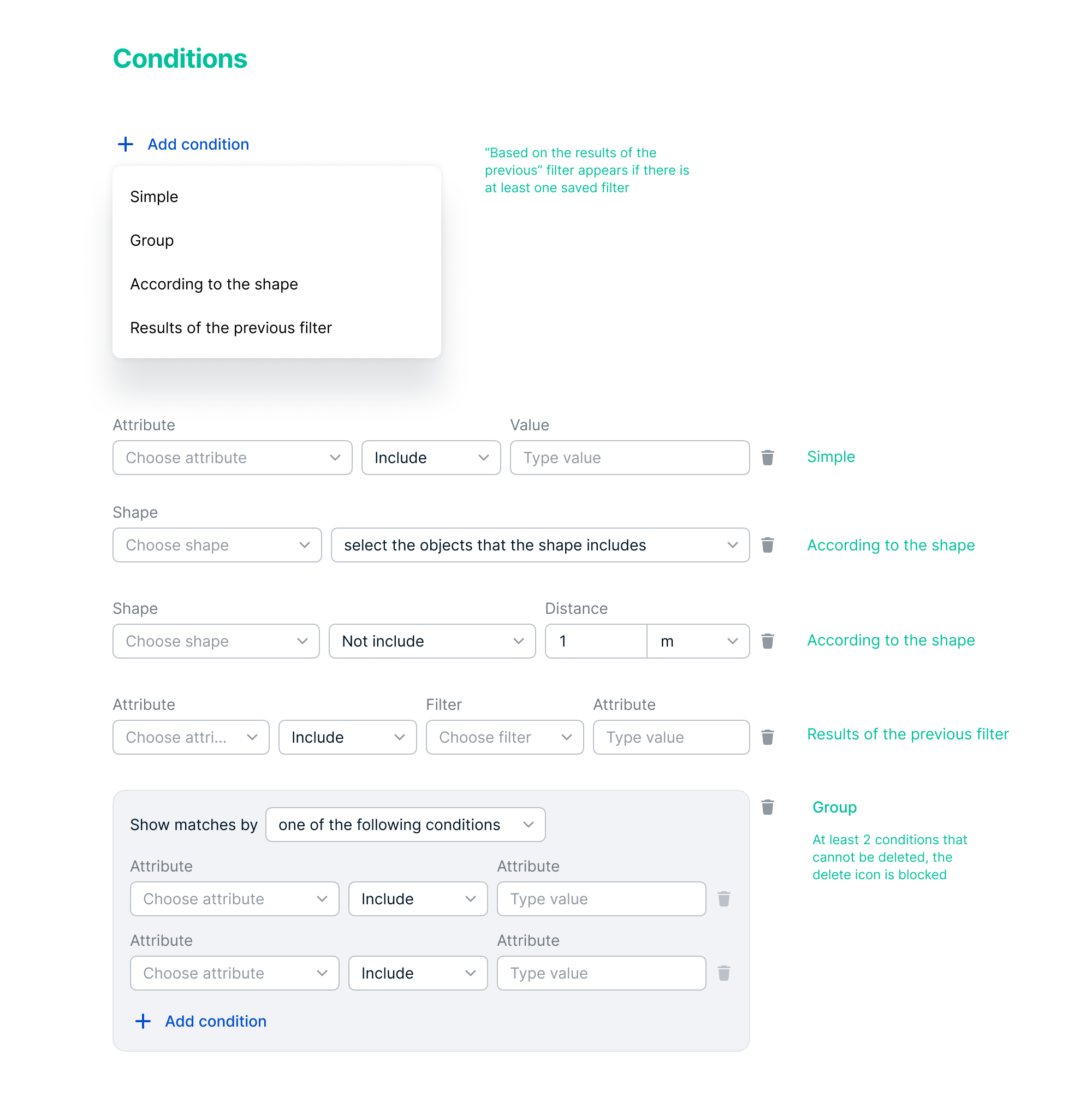
The entire spec for filters
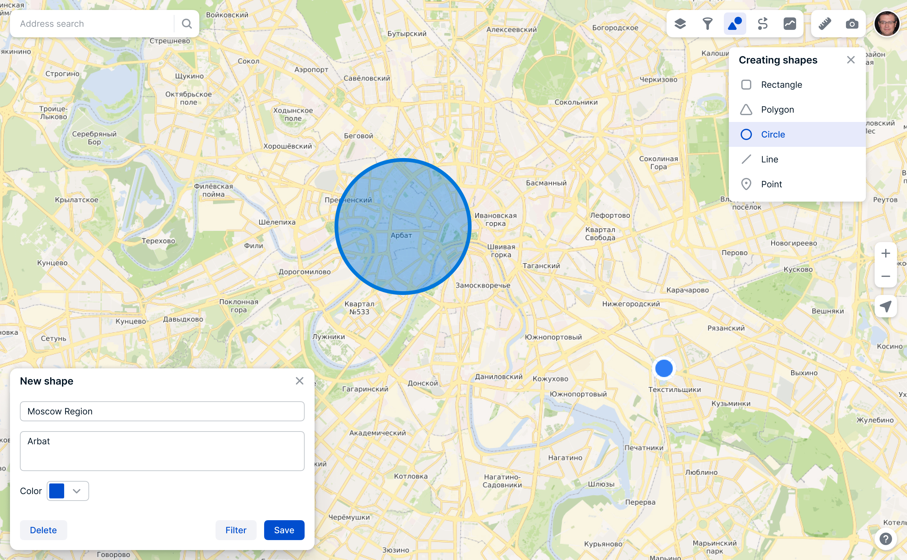
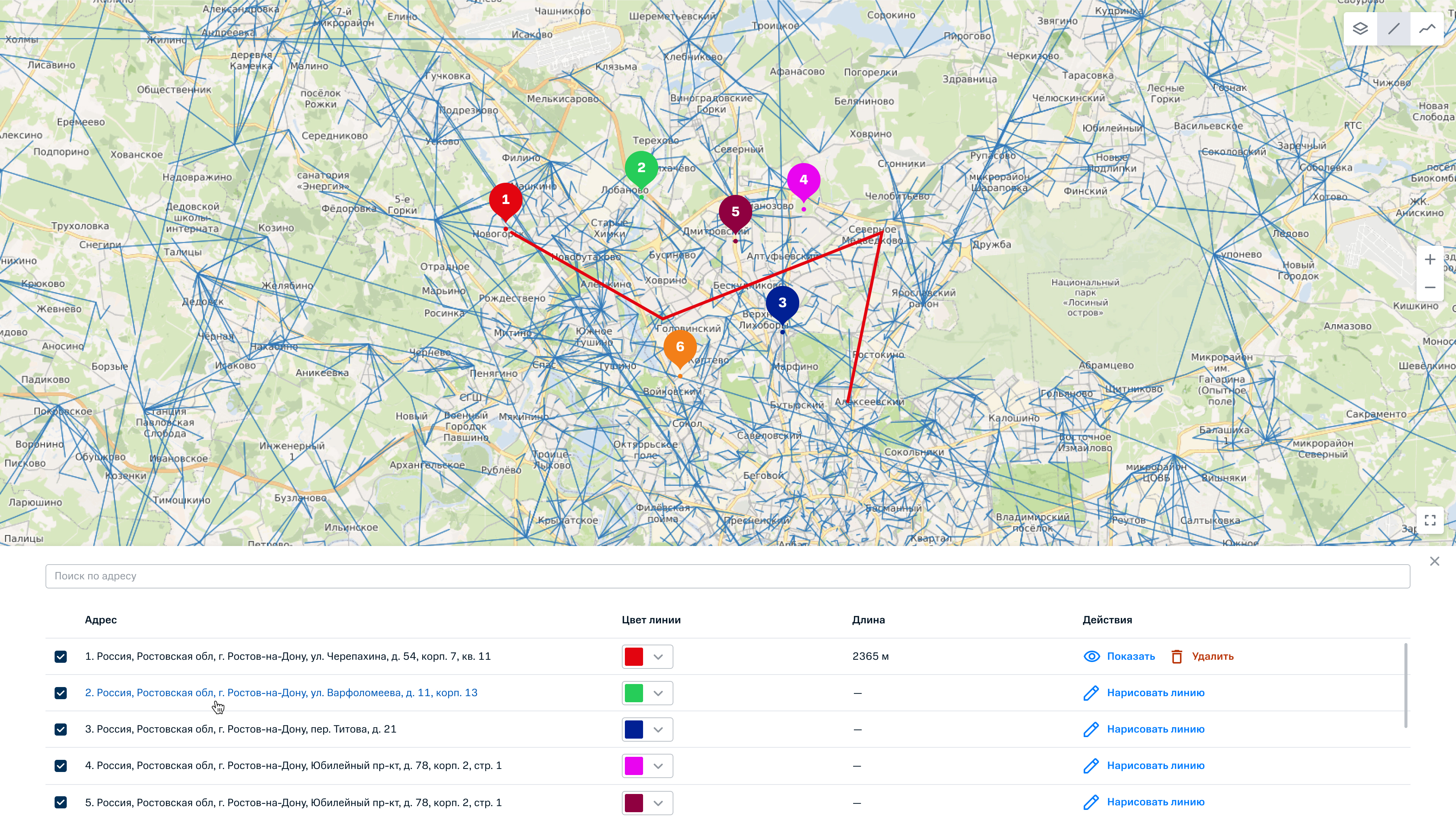
You can use shapes to quickly mark something you need so that you won’t lose it later. You can also filter objects by shapes. For example, you can set the point of the desired trade showroom and see what competitors’ showrooms are within a certain radius.
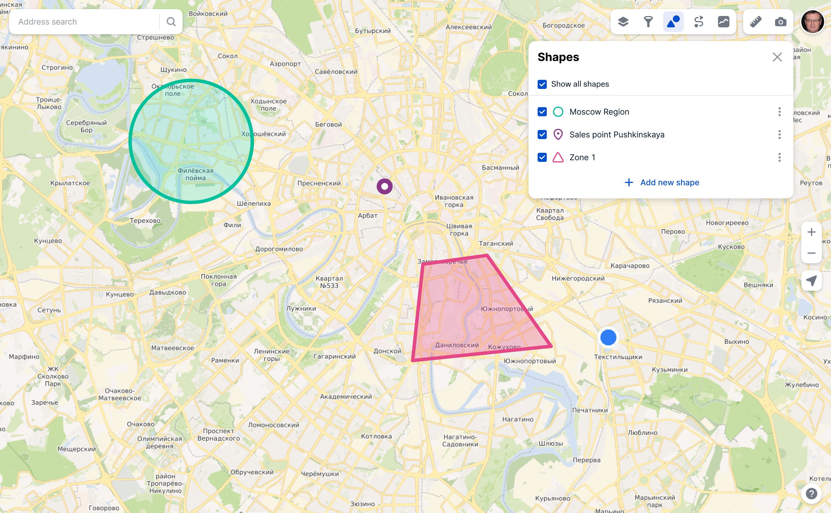
Creation of a new shape
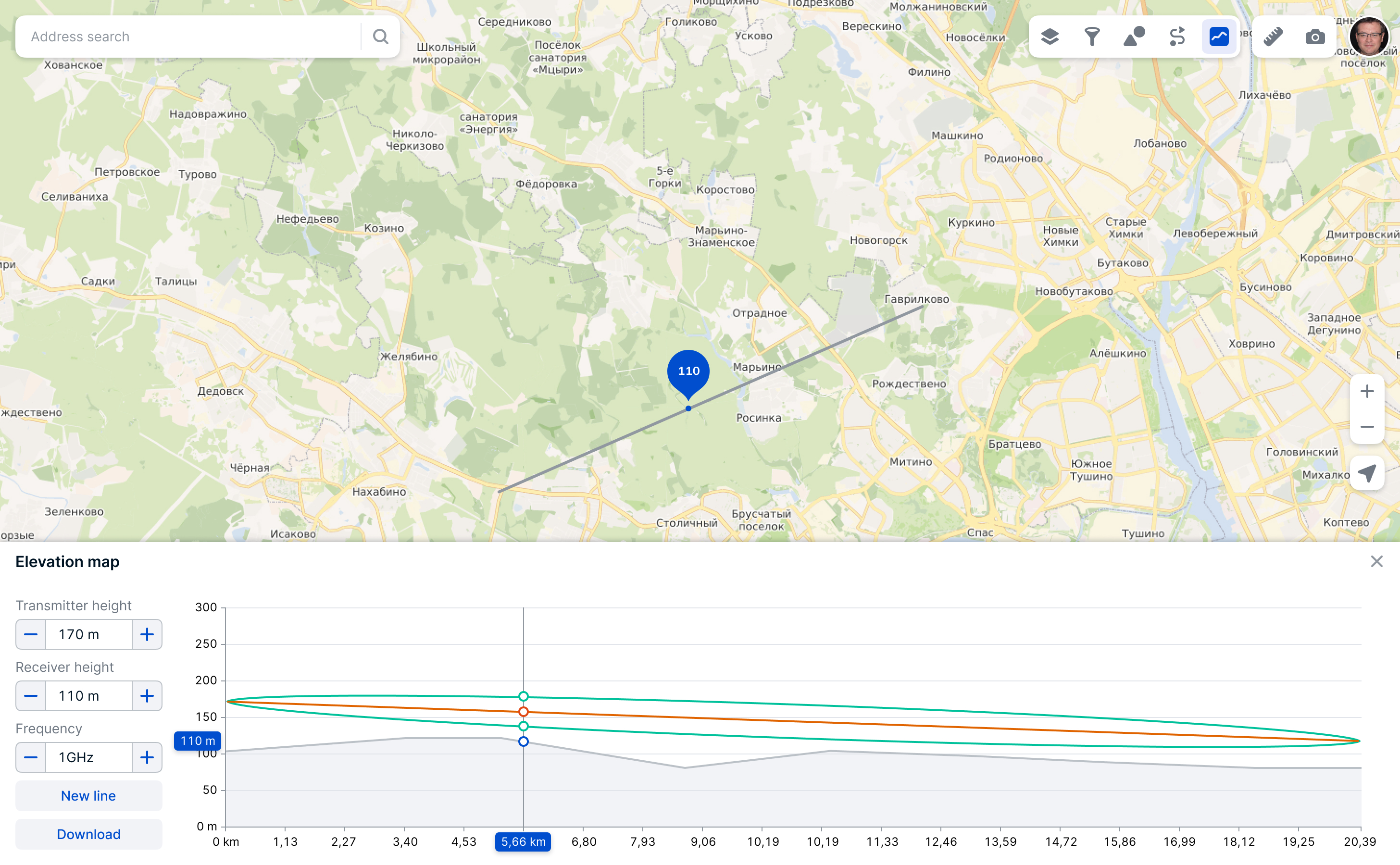
The terrain elevation map is used to install new cellular equipment and helps calculate the necessary height of the cellular receiver and transmitter. For communication to work, there must be no interference between the transmitter and the receiver.
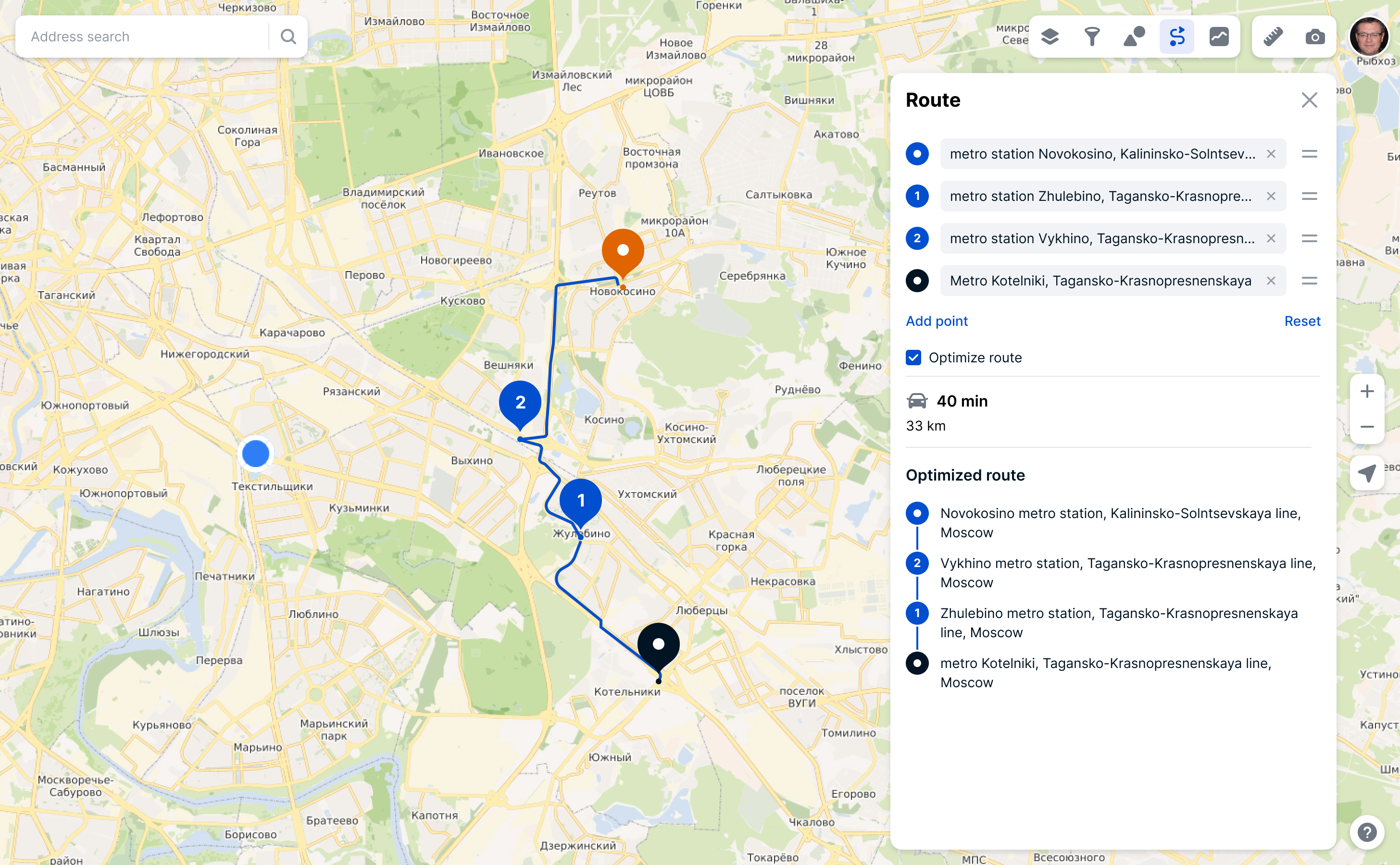
Constructing routes and optimizing the passage of waypoints with maximum time savings. In the future, it was planned to make a full-fledged navigator for engineers, couriers and agents who do field work.
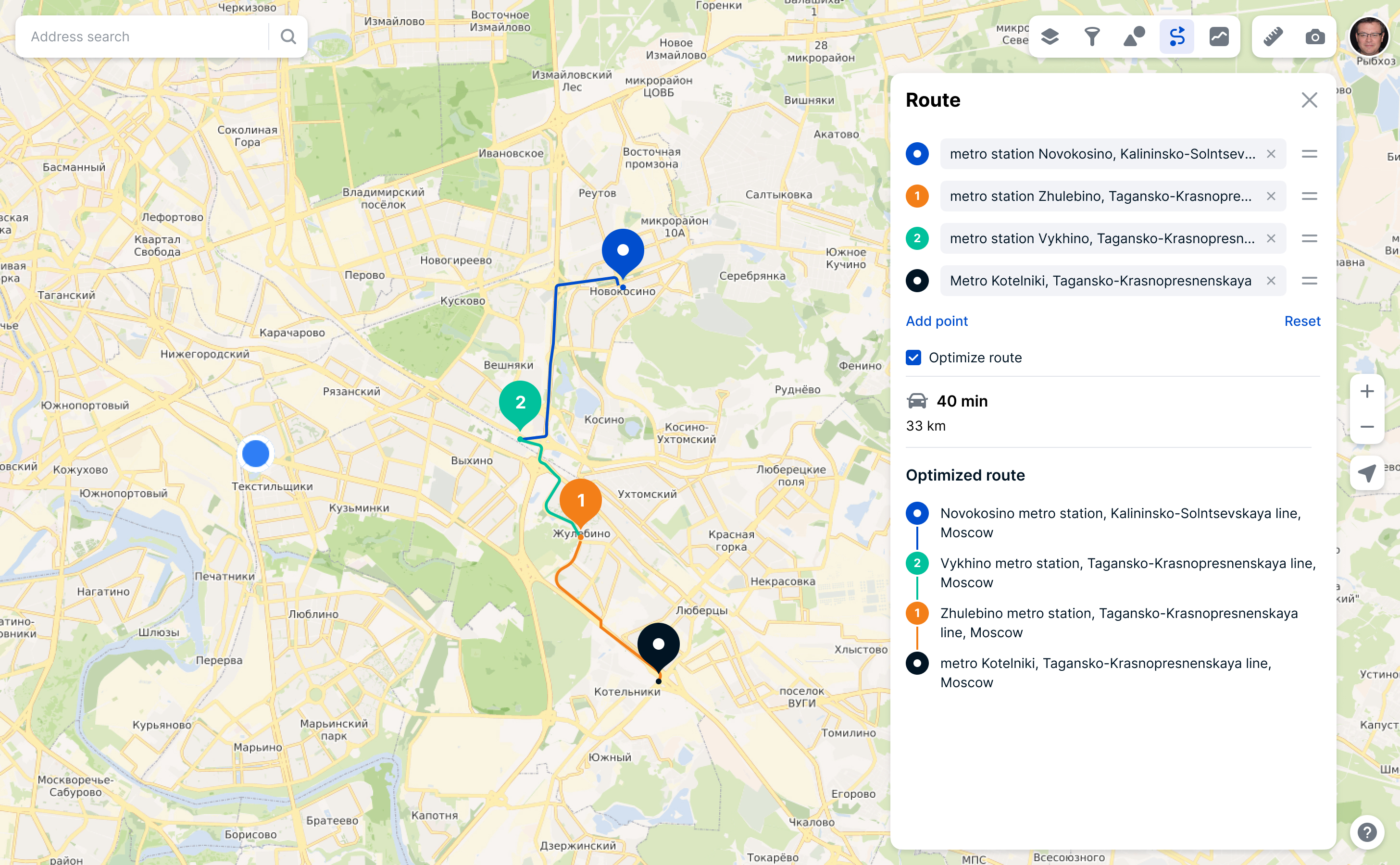
The first variant was without color difference between point. But test showed that it’s very hard for respondents to work with optimized route without color difference.
Also I did the icon set:
We launched Egis and did the biggest demo of internal products in company for 700 people. Added more than 500 users from different different departments before official launch.
Egis can be embedded by iframe into any other application or service. You can leave only the features and data displayed and add new ones. During my work in company we used Egis and its tools in two more services.
Garnet: layers with information, figures, elevation map
F1: map, search and layer with base stations